QGIS for Conversion of degree decimal co-ordinates to UTM co-ordinates
This article will share the conversion process of coordinates such as degree decimal to UTM coordinates. Usually, while collecting the data using GPS from the field, the coordinates are in degree decimal format.
For conversion of degree decimal co-ordinates to UTM coordinates, one need to use converter from different website and excel tool. But these tools are also available in GIS software.
So in this article process of converting coordinates from degree decimal to UTM in QGIS is shared with screen shots.
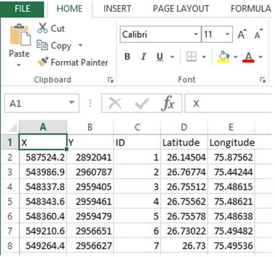
In the beginning, one has to copy the degree decimal coordinates into Excel file as shown below. The data should have following descriptions such as point ID, Latitude and Longitude. Now save this excel file as Comma Delimited format (.CSV format).

Now Open QGIS by clicking on Startthen go to All Programs and then click QGIS Desktop 3.8.3. Following window will open
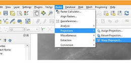
Open the .CSV file via Layer then click Add Layer followed by Add Delimited Text Layer

Following pop up window (Data source manager Delimited Text) will open.
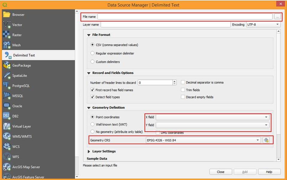
In the above shown window you have to define three parameters as marked with red boxes. First browse and select the .CSV file in File name. Then in Geometry definition select point co-ordinates and for X field put Longitude while for Y field put Latitude.
Now specify Co-ordinate reference system (CRS) ie, World Geodetic System 1984 (WGS 1984). We have selected the WGS 84 because our data is latitude and longitude data and belongs to WGS 84 co-ordinate system not to other projection system.
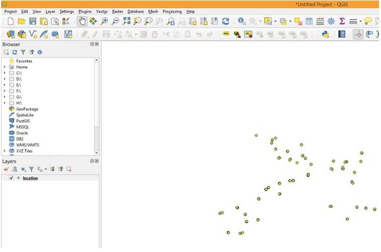
Now click on Add button and close the window. You will see that all the points has been imported in the map window as shown below.
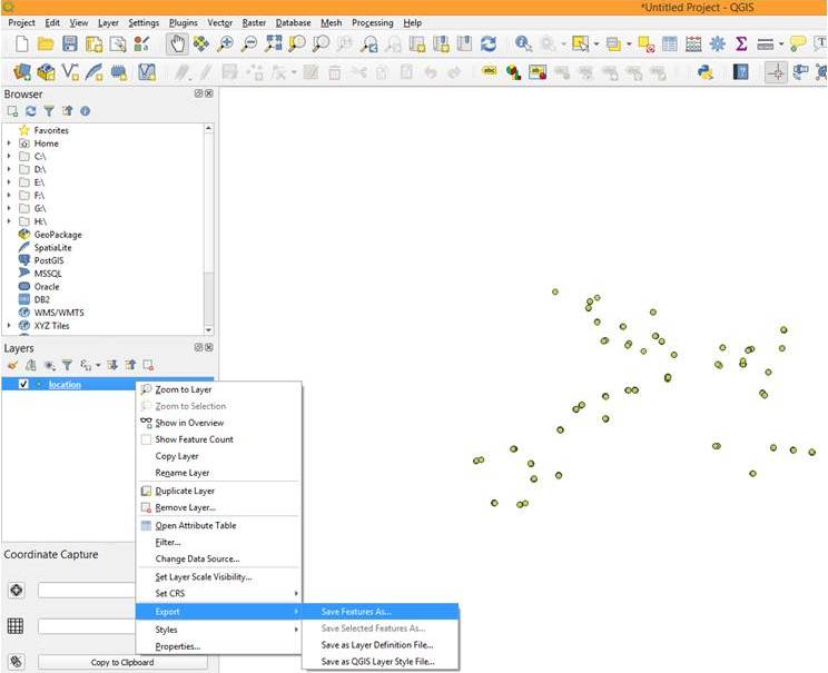
These points are in latitude and logitude, so now you have to export the data to other projection system such as UTM. So right click on layer, then go to Export followed by Savefeature as
Save vector layer as window will popup.
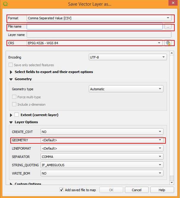
You have to define the parameters highlighted with red boxes. First select the format in which you want to export thr points. For example, here I have selected CSV format. Now define output file name and location.
Now specify Co-ordinate reference system (CRS) ie, UTM. For my area UTM zone is 43 so I have selected UTM zone 43N in CRS popup window as shown below

After defining the co-ordinate system Click on ‘OK’
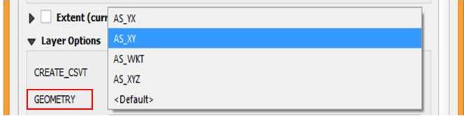
Then in Save vector layer as window define GEOMETRY with AS_XY, click OK
Now your co-ordinate conversion is over. Open the output CSV file you can see the UTM co-ordinates as XY as shown below
By the above process and steps one can convert coordinates in QGIS.
Collaboration is a key part of that, from team editing of documents and presentations, to staff and supervisor updating of time keeping spreadsheets. If you need any kind of information, don't forget to visit MyPCFile
I am really happy to say it’s an interesting post to read. I learned new information about Online Free Content Editor Tools from your post, you are doing a great job. Keep it up.