The ability to subset a satellite image to concentrate on a particular area of interest (AOI) within a wider image is significant since it improves the efficacy and efficiency of image analysis. The following are some main advantages and uses for subsetting satellite images:
Benefits of Subsetting:
Shorter Processing Time: Subsetting shortens the processing time by concentrating on a smaller region, which expedites analysis and display updates.
Effective Resource Use: By generating smaller files with only the pertinent data for the research region, subsetting can save disk space.
Better Analysis Focus: It enables analysts to focus on particular AOI traits or phenomena without being distracted by unimportant data.
Techniques for GIS Satellite Image Subsetting
By Coordinates (Bounding Box) Using latitude and longitude coordinates, define a rectangle region.
Only the area of the image contained inside these coordinates should be extracted.
By AOI (Masking/Clipping) or Polygon.
The raster picture can be clipped using a shape file, vector layer, or drawn polygon.
Only pixels inside the specified boundary are extracted. Using a Raster Mask- Use the existing raster layer to mask a raster image as per the requirements
Applications of Subsetting
Environmental Monitoring: Within a narrower area, subsetting can be used to track particular environmental trends, like urbanization or deforestation.
Agriculture Analysis: By concentrating on agricultural regions, it aids in evaluating crop health and growth trends.
Disaster Response: By identifying regions impacted by natural catastrophes such as floods or wildfires, subsetting can help focus relief efforts.
ArcGIS Steps-Subset a Satellite Image
In ArcGIS, click on File then go to Add data. Here Add data dialog box will pop up.
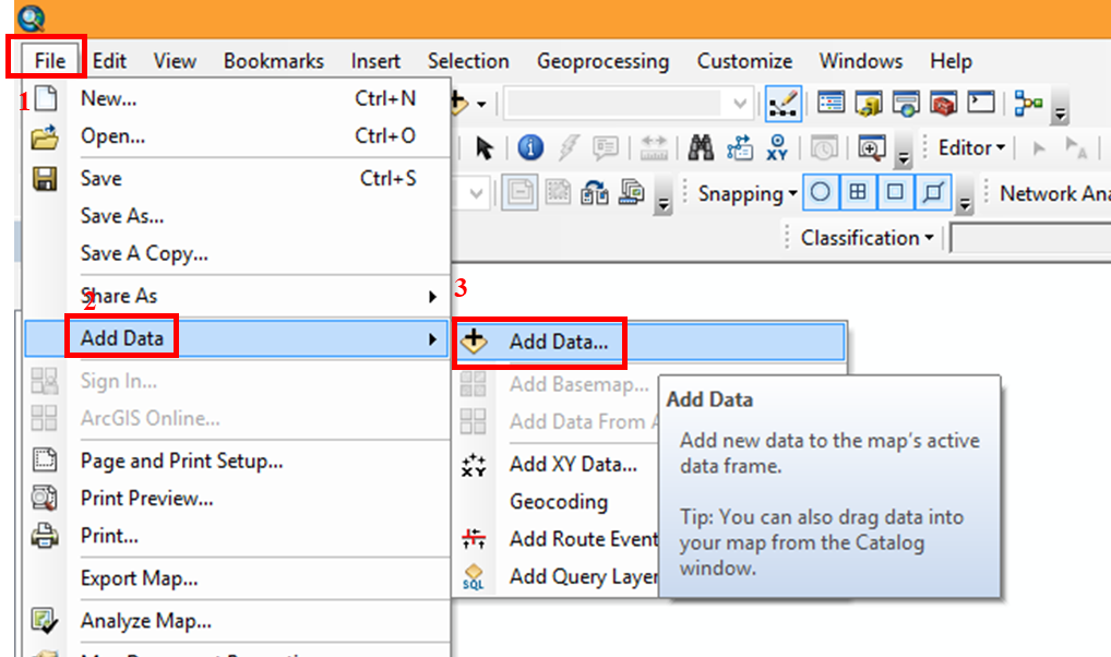
- Select drive to open the folder of satellite images.
- Select the image file and then click Add in the window.
- Image will display on the screen.
- In the same way add the area of interest file (*.shp format) through which you want to subset the raster data.
- Now open the Arc Toolbox window by clicking on Geoprocessing tab in ArcGIS Menu Bar.

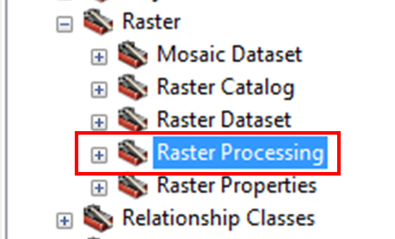
Here in Arc Toolbox, you have an option ie. Data management tools, just double click on it. It will expand the list of tools available. Here you will find the tool called Raster, double click this tool.
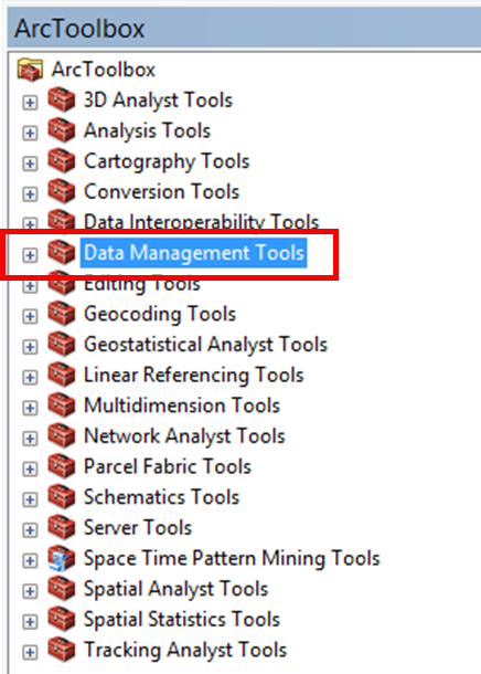
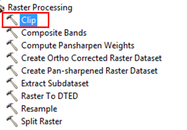
Then under Raster you will find the tool Raster processing. Double click on that tool also. Here you will find the option called Clip, which will cut the portion of the raster data based on the polygon feature (*.shp file).
Select the Clip fir further process
Click on Clip, it will open the Clip dialog box .
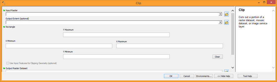
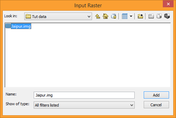
In Clip dialog box define Input Raster ie. raster dataset which you want to subset. For this navigate the folder location of satellite image file, select the image and click to Add button.
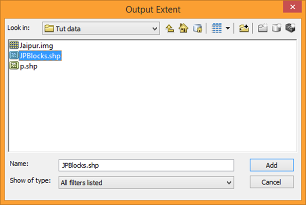
Then define Output Extent by selecting *.shp file and click to Add button.
- Now check the box Use Input Features for Clipping Geometry.
- Ensure that No Data value is set to 0 and Click OK.

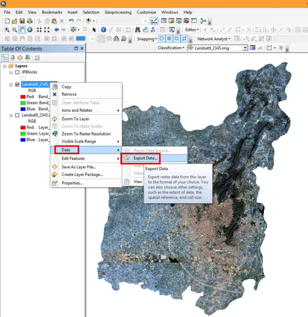
Clip process will run, and after finishing the process, it will display the clipped satellite data on the ArcGIS screen. One can save the clipped imagery to the desired location by using the Export data option.
The subset image reduces the time to classify a satellite image and helps to concentrate on the applicable study area of research.