Use of Band Combination in Satellite Image Processing
In satellite image processing, Band combination is the act of choosing and positioning certain spectral bands to highlight particular Earth surface features. Analysts can visualize and extract data on urban areas, geology, vegetation, water bodies, and more using various band combinations.
Types of Band Combinations
Multiple spectral bands taken at various wavelengths (visible, infrared, microwave, etc.) make up satellite images. The particular application determines which band combination is best.
1. True Color (Natural Color) Combination
(Red, Green, Blue: RGB = 4,3,2 for Landsat-8 or 3,2,1 for older sensors)
- It is easy to interpret since it mimics normal eyesight.
- Ideal for broad landscape evaluation and urban planning.
- Restrictions: Not as good at identifying water penetration or vegetation health.
2. False Color (Near-Infrared) Combination
(NIR, Red, Green: RGB = 5,4,3 for Landsat-8 or 4,3,2 for older sensors)
- Because of its high Near-Infrared (NIR) band reflectance, vegetation appears red.
- Supports water body analysis, deforestation research, and vegetation monitoring.
3. Shortwave Infrared (SWIR) Combination
(SWIR, NIR, Red: RGB = 7,5,3 for Landsat-8)
- Improves soil, scorched areas, and moisture content.
- Beneficial for geological research and wildfire detection.
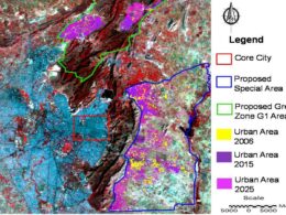
4. Urban Band Combination
(SWIR, NIR, Blue: RGB = 7,6,4 for Landsat-8)
- Uses gray or purple hues to draw attention to populated regions.
- Excellent for charting infrastructure and urban growth.
5. Agricultural Band Combination
(NIR, SWIR, Red: RGB = 6,5,2 for Landsat-8)
- Distinguishes between crop kinds and stress levels.
- Supports land use classification and precision agriculture.
6. Water Body Enhancement Combination
(SWIR, NIR, Green: RGB = 7,5,4 for Landsat-8)
- Improves water bodies and aids in differentiating between shallow and deep water
- Useful for wetland research and flood monitoring.
7. Thermal Band Combination (for Heat Mapping and Wildfire Monitoring)
- To identify temperature changes, thermal infrared (TIR) bands are used.
- Aids in the detection of volcanic activity, heat islands, and forest fires.
Steps to change band combination in ArcGIS
Band combination can be changed by Right click on image name then go to Properties
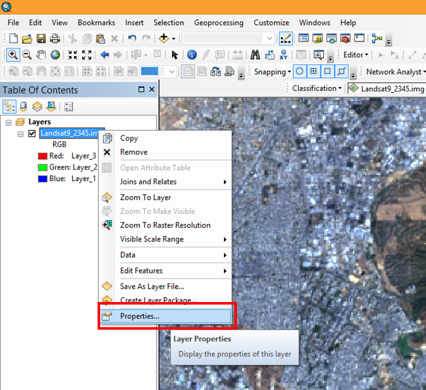
Layer Properties dialog box will pop up.
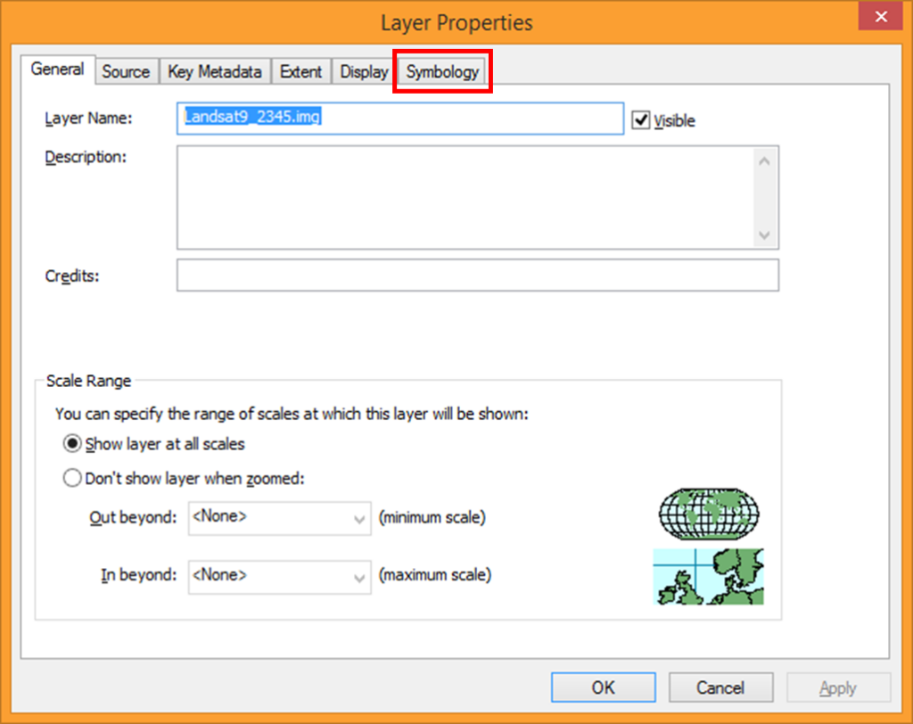
In this dialog box click on Symbology tab and define RGB as 432
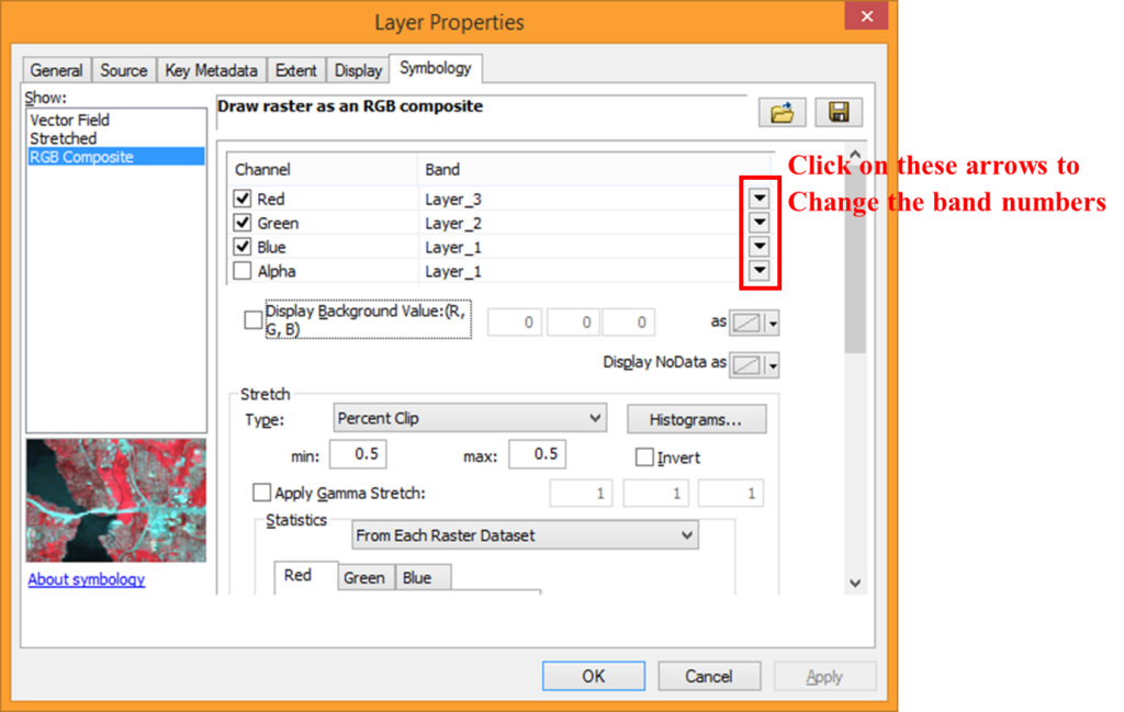
Here click on Symbology tab and define RGB as 432. Then click Apply followed by OK.
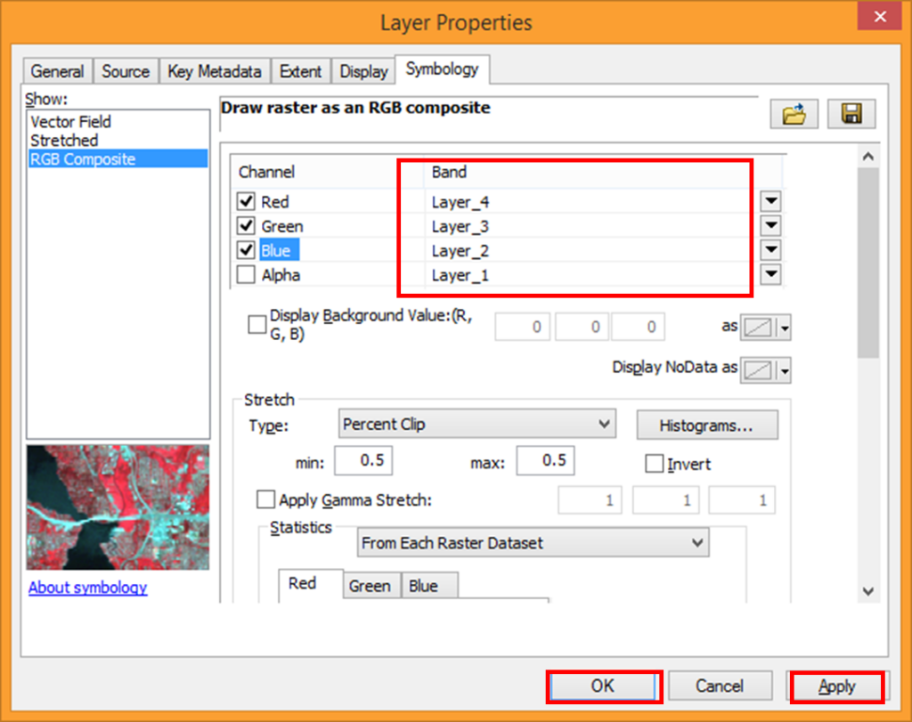
Image will display as False Color Composite image in which vegetation is displayed in Red color for better image interpretation.
Importance of Band Combination in Image Processing
• Based on spectral qualities, it improves particular features.
• Supports disaster management and environmental monitoring.
• Aids in the management of water resources, agriculture, and urban development.
• Supports mineral and geological exploration.