What is GPS and How does GPS work? GPS (Global Positioning System) GPS is a satellite-based navigation system used byadminMarch 22, 2025
How to subset a satellite image in ArcGIS? The ability to subset a satellite image to concentrate on a particular area of byadminMarch 4, 2025
How to Change Band combination of satellite image in ArcGIS Use of Band Combination in Satellite Image Processing In satellite image byadminFebruary 24, 2025
Layer Stacking or Band composite of Landsat Satellite data using ArcGIS Integration of numerous spectral bands of Landsat byadminFebruary 17, 2025
GIS Tutorials GNSS UncategorizedMarch 22, 2025 What is GPS and How does GPS work? GPS (Global Positioning System) GPS is a satellite-based navigation system used byadmin
GIS Tutorials Remote Sensing RS AnalysisMarch 4, 2025 How to subset a satellite image in ArcGIS? The ability to subset a satellite image to concentrate on a particular area of byadmin
GIS Tutorials Remote Sensing RS AnalysisFebruary 24, 2025 How to Change Band combination of satellite image in ArcGIS Use of Band Combination in Satellite Image Processing In satellite image byadmin
GIS Tutorials RS AnalysisFebruary 17, 2025 Layer Stacking or Band composite of Landsat Satellite data using ArcGIS Integration of numerous spectral bands of Landsat byadmin
GIS Tutorials RS AnalysisFebruary 10, 2025 ArcGIS Tutorial on Adding Satellite Image/Basemaps in ArcGIS Overview A key element of Geographic Information Systems (GIS) is satellite byadmin
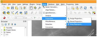
GIS Analysis GIS TutorialsAugust 26, 2020 How to Process Cartosat DEM using QGIS- Reproject, Clip and Stream Generation This article is the continuation of an earlier article on downloading and byadmin
GIS Analysis GIS TutorialsJuly 1, 2020 Buffer Analysis using QGIS Introduction to Buffer Analysis GIS provide many tools for understanding and byadmin
GIS Analysis GIS TutorialsJune 23, 2020 QGIS for Interpolation of Spatial Data Introduction to Interpolation Process for Spatial Analysis Continuous spatial byadmin
GIS Analysis GIS TutorialsMay 22, 2020 Conversion of Coordinates (Latitude/Longitude) using QGIS QGIS for Conversion of degree decimal co-ordinates to UTM co-ordinates This byadmin
GIS Analysis GIS TutorialsMay 4, 2020 How to Create Polygon Features in QGIS Software Polygon Feature creation using QGIS GIS can be used to create spatial data byadmin