How to download Landsat Images
Satellite images required for mapping and monitoring natural and man-made features. There are different type of satellite images available for mapping from high resolution such as worldview, quickbird, LISS-IV etc., and medium resolution satellite images such as Aster, LISS-III and Landsat, where as in low resolution, AWiFS, MODIS etc.
These satellite image cost vary with it’s resolution and available as per its temporal resolution. Satellite image acquiring process is important to understand for mapping.
This article will discussed about Landsat Satellite mission as well as process of downloading Landsat satellite image. Landsat mission is one of the oldest mission of earth observing satellites and this mission is still alive in the form of Landsat 8. As Landsat mission started in 1970s so satellite images can be acquired from that period to ascertain the changes.
LANDSAT MISSION
This US (NASA and USGS) satellite remote sensing program was the first civil earth-observing satellite program. It started with the first Landsat satellite’s launch in 1972 and is continuing with Landsat 8, recently launched.
Since June 2009, the entire Landsat image archive is available at no charge online (see website Earth Explorer from the U.S. Geological Survey).
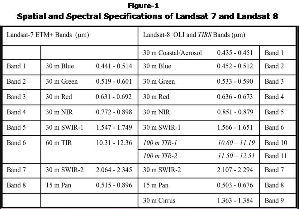
Landsat 7
Landsat 7 was launched in 1999 and is equipped with a multi-spectral sensor known as the Enhanced Thematic Mapper Plus or ETM+. The Enhanced Thematic Mapper Plus (ETM+), imitates the competencies of the highly successful Thematic Mapper instruments of earlier Landsat series. The ETM+ also have some additional features that make it a more resourceful and efficient instrument for global change studies, land cover monitoring and assessment, and large area mapping than its design forebears.
Some features are:
- a panchromatic band introduced with 15m spatial resolution
- a thermal IR channel with 60m spatial resolution
- an on-board data recorder
Landsat 7 is the most accurately calibrated Earth-observing satellite, its measurements are extremely accurate when compared to the measurements made on the ground. Landsat 7’s sensor has been called the most stable, best characterized Earth observation instrument ever placed in orbit.
Orbital Specifications are
- Altitude: 705 km
- Inclination: 98.2 degrees
- Orbit: sun-synchronous polar
- Orbit period: 98.9 minutes
- Revisit time: 16 days
Landsat 8
It is Launched on February 11, 2013, Landsat 8 (formerly the Landsat Data Continuity Mission, LDCM) is the most recently launched Landsat satellite. It is collecting valuable data and imagery used in agriculture, education, business, science, and government. The Landsat 8 satellite payload consists of two science instruments—the Operational Land Imager (OLI) and the Thermal Infrared Sensor (TIRS).
These two sensors provide seasonal coverage of the global landmass at a spatial resolution of 30 meters (visible, NIR, SWIR); 100 meters (thermal); and 15 meters (panchromatic). OLI’s design is an advancement in Landsat sensor technology and uses an approach demonstrated by the Advanced Land Imager sensor flown on NASA’s experimental EO-1 satellite. Instruments on earlier Landsat satellites employed scan mirrors to sweep the instrument fields of view across the surface swath width and transmit light to a few detectors. The OLI instead uses long detector arrays, with over 7,000 detectors per spectral band, aligned across its focal plane to view across the swath.
Source: https://landsat.gsfc.nasa.gov/landsat-8
Steps to Download Landsat Satellite Image
Download free satellite images of Landsat Satellite using United National Geological Survey (USGS) website. The big advantage of Landsat image is that one can download image from early 70s to till date or recent image such as may be of yesterday. So to download Landsat images Open Google Search Engine and type download Landsat Satellite Image. (Figure 2)
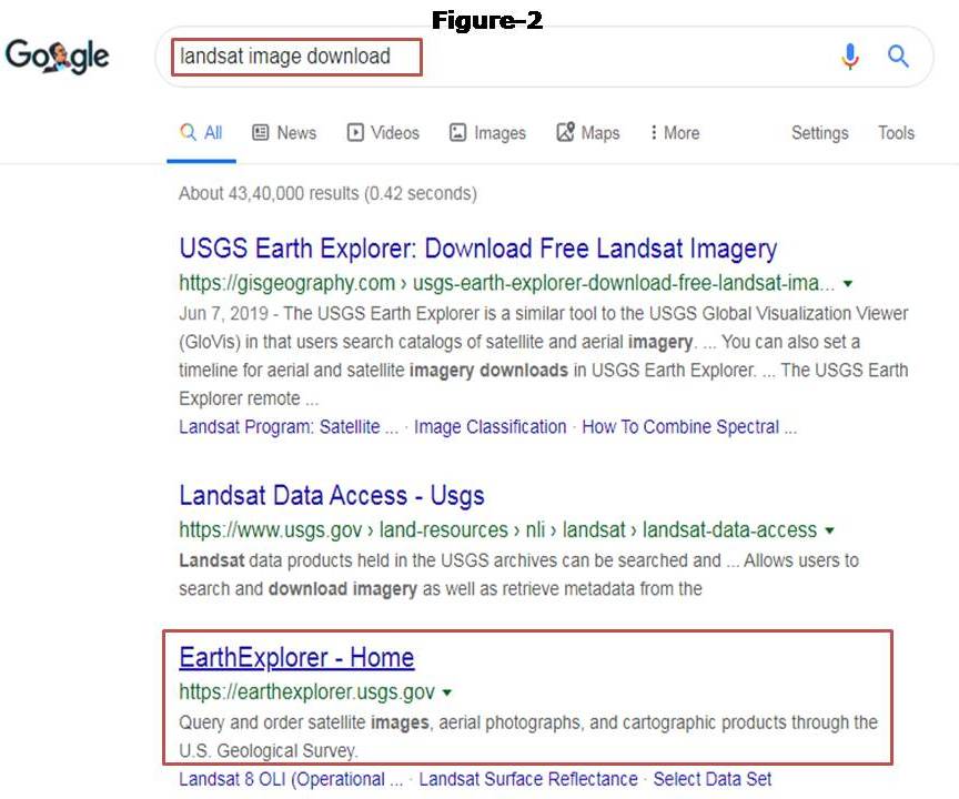
or Open web link: https://earthexplorer.usgs.gov
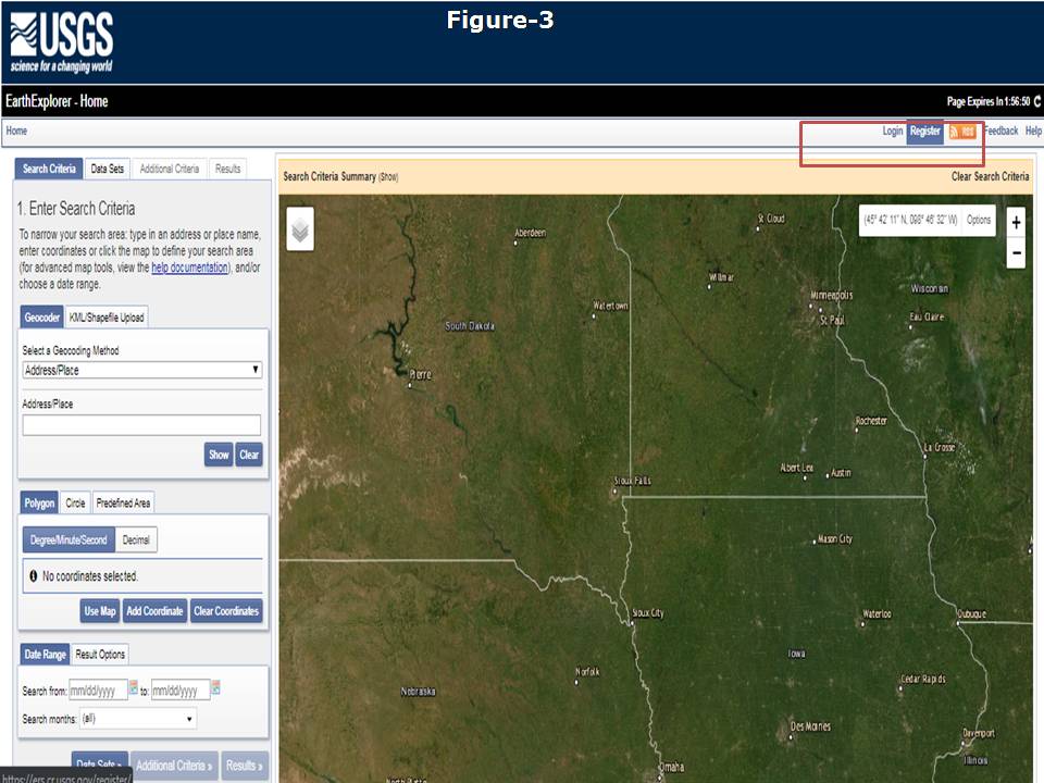
A new window will open after clicking on above link.
You need to make user id on this page so click to Register (on the extreme top right corner) (Figure 3)
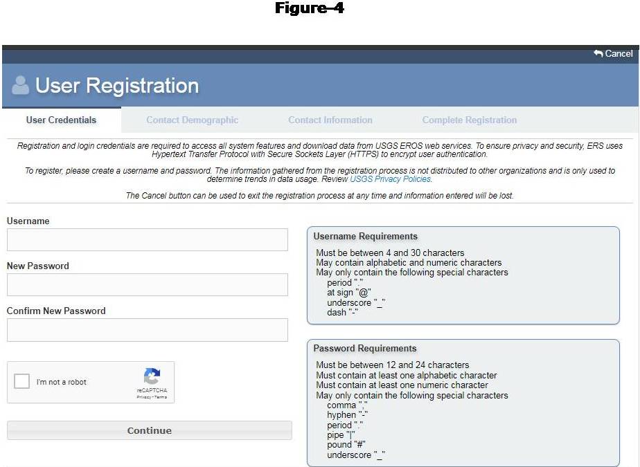
A new small window will open for Register credentials, fill all details in all tabs such as user credential, contact demography, contact information and complete registration. Create login id by providing details such as user name, email id, first name, last name etc. (Figure 4)
Now move to search and download satellite image.
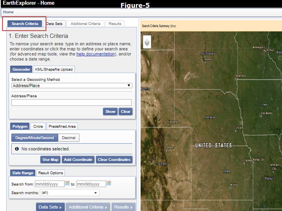
Select the search criteria tab (extreme top left corner outlined in Red box) in the beginning in the window. (Figure 5)
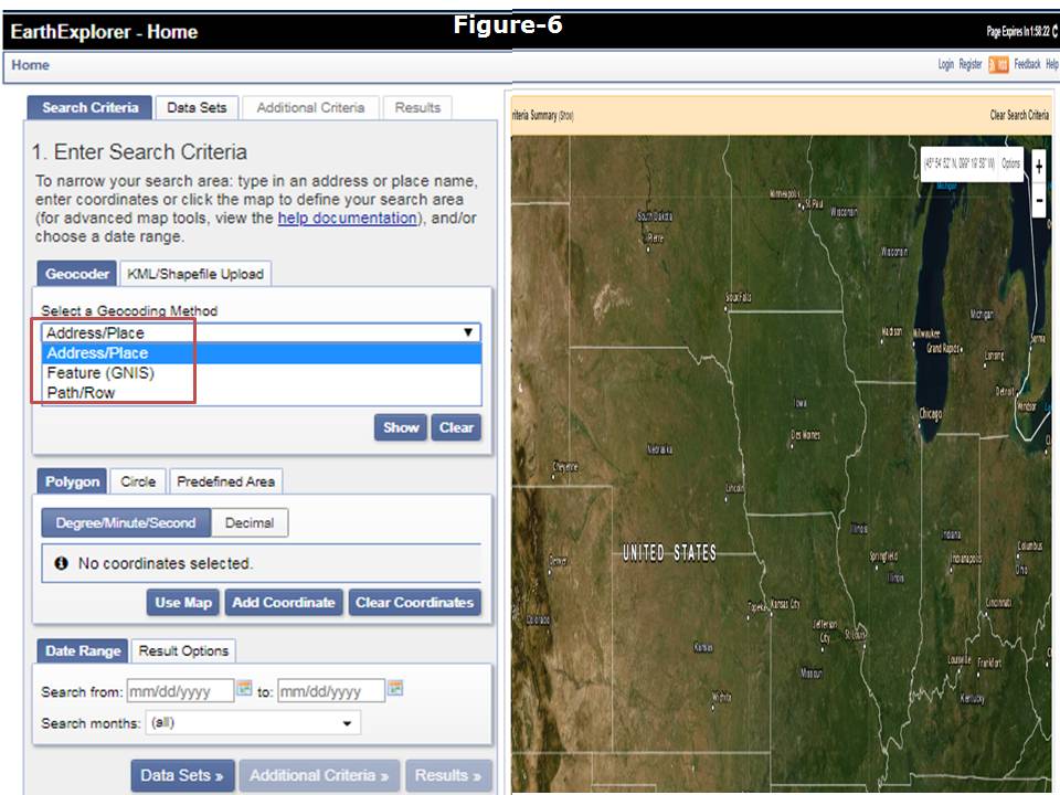
To select area of which you need to download satellite images one can click on Select Geocoding method and opt for address/place. (Figure 6)
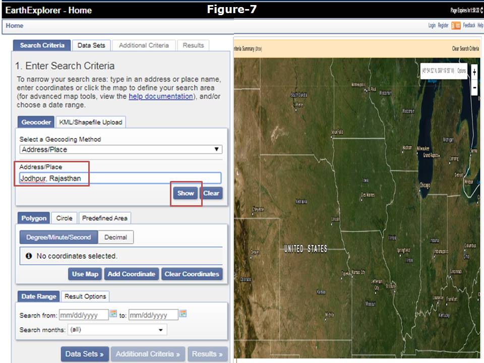
Than type address or place of your interest by typing in the bar. In this example Jodhpur, rajasthan is provided. After this click on show button. (Figure 7)
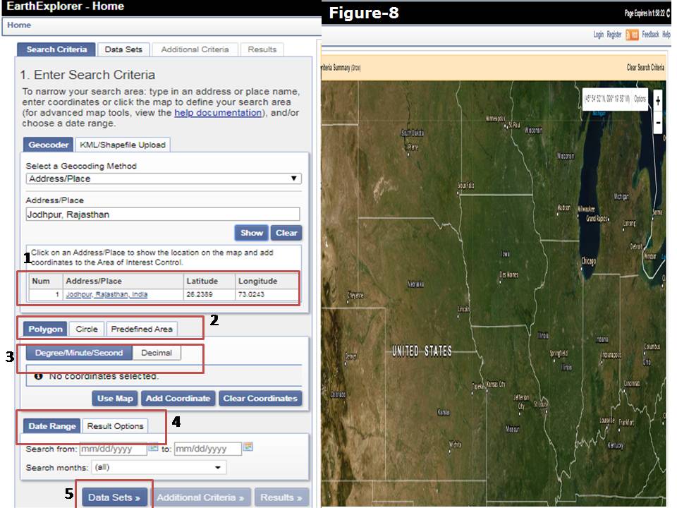
Now you can see in the Figure 8 address as well as lat/long of Jaipur is displayed Box1. After this one can defined the area of interest in the form of polygon as visible in Box2. Interest area can be searched by providing Lat/long in DMS or DD as in Box3. Satellite data set can filtered using date range as Box4. Now click on data set as in Box5.
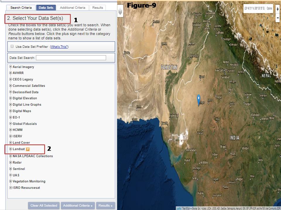
As per Figure 9 it is visible in second Tab i.e. Data sets, Select data set as represented in red Box1. There is a long list is available of different satellite images in the data set. Click for Landsat Image as highlighted in Box2.
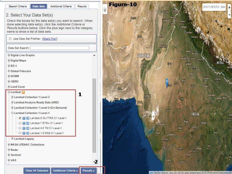
When one click on Landsat, it will be expanded and there are different options of Landsat, so go to Landsat Collection 1 Level 1. Opt for Landsat Landsat 8 OLI/TIRS C1 Level-1 as in the Box1. Then click on Results as highlighted in Box2. (Figure 10)
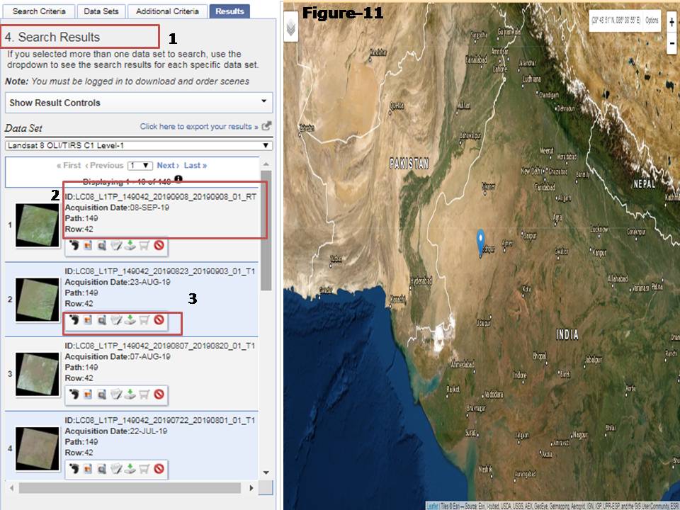
Now the search results are displayed in Search Results as in Box1. As it is visible that there are many satellite images are there in results window. Every satellite image have id, acquisition date and Path/Row as defined in Box2. As shown in Box3 satellite image can be previewed and download by using options. (Figure 11)
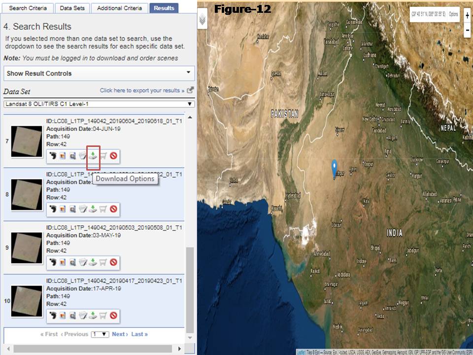
Below image shows the option on which one can click and start downloading by saving in your drive folder. (Figure 12)
Landsat Image will be available band wise so one has to layer stack satellite image by using layer stacking tool of Erdas software to make color composite image and display in Image processing software.
Video also uploaded for quick process
very interesting work