Urban sprawl, an outcome of socioeconomic development and population under certain conditions, is continuously increasing. It becomes a major issue facing by many metropolitan cities of developing and developed countries.
Urban sprawl is often took as scattered suburban development that create and increase several issues-
-
Stress on basic amenities
-
Traffic problems,
-
Reduce local resources, and
-
No more open space
It is important to appropriately illustrate urban sprawl in order to prepare a complete understanding of the causes and effects of urban sprawl processes. Urban sprawl is often assessed and characterized based on major socio-economic factors such as
-
Growth in Population
-
Employment Shifts
-
Revenue Generation in City
-
Commercial Development Status
Urban sprawl, in most cases associated with poor land use plan and economic development and activities.
This above approach based on socio-economic factors cannot effectively identify the influences of urban sprawl in a spatial context. To overcome from this gap, remote sensing and GIS have been used to detect urban land cover changes in relation to urban sprawl.
Remote sensing technique has many advantages in describing the spatio-temporal changes of urban sprawl using multi-band and multi-date images. This process is providing current scenario of urban sprawl and its impact on surrounding as well as past events of urban sprawl can be assessed using this technology.
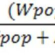
This urban sprawl can be projected for future based on current growth and past trends using Remote Sensing and GIS technology. There are several simulation models can be used to project urban sprawl and can be integrated in GIS and remote sensing system for projecting future urban sprawl.
These models also allow to integrating variable and factors which influence urban sprawl. These factors can be location based such as proximity to amenities, distance from major roads, elevation etc and socio-economic based such as population density, density of transportation/commutation system etc.
These factors can be created using GIS functions such as proximity analysis and spatial analysis. As GIS is advantageous in creation of such spatial data and has application in each and every field.
These location based and socio-economic factors can be created using non spatial data as well as in both raster and vector format of spatial data.
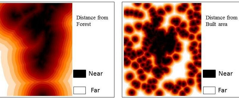
Below images are shown in figure, these are location based factors created using GIS tool.


Figure Shows use of GIS Spatial Tool to Create Location Based Factors
These projected urban sprawl/land use maps can be assessed using past or previous year satellite image and compare with current urban sprawl. This process helps to understand the accuracy and errors of the simulation model.
If the accuracy is acceptable then this model can be used to project urban sprawl for future such as urban sprawl after 5 years or 10 years.
These previous satellite data processed using image processing software and by following basic steps to create urban sprawl and land use database-
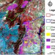
This classified satellite images and location based and socio-economic factors can be integrated in simulation model to project urban sprawl for future. As shown in the below figure, satellite images of previous year used to create simulated/projected maps and compare with the actual maps created using satellite image of the period/year.


Figure Show Actual Mapped and Projected Land Use Maps
Such information can support policy making for urban planning and natural resource conservation. As it reflect the current as well as future scope of urban sprawl.