Geospatial Technology, which is also called Remote Sensing and GIS Technology will be a game-changing technology for monitoring, planning, and management of natural resources provided by Mother Earth. We need to invest in our planet for the survival of humankind and preserve natural resources for the coming generations. To conserve natural resources available on earth, a basic approach is required, which includes the below steps
Estimation of Availability of Natural Resources
Control of natural resources, therefore, Need Monitoring Natural Resources
Make availability to humans – Need Proper Planning of Available Natural Resources
Distribution of Natural Resources for Mankind– A proper management approach
Conserve Natural Resources – Policies to conserve resources
Scope for investment – Find the opportunities for investment in our planet.
To reach above mentioned steps, need to focus on investing in our planet in such a way that leads to conserving and consuming natural resources. In the above approach, GIS and Remote Sensing technology can play an important and significant role. Geospatial technologies have 100% scope in estimation, control, planning, and management and conserve natural resources as well as find the ways and platforms to invest in our earth.
Geospatial technologies give us map natural resources and find the control measures to conserve natural resources. The capabilities of remote sensing enable us to find the availability of resources and GIS allows us to measure the availability of resources.
GEOSPATIAL TECHNOLOGY Advantages for Investment in Our Earth-
Here Below shared some advantages of geospatial technologies to find the prospects to invest in the earth for conservation and preserve natural resources for the coming generations.
This technology can combine existing old databases as well as integrate new data for the generation of a specific database. For example- Forest area delineation and extraction can be prepared using previous satellite images, existing maps, and survey data in combination with recent satellite images and survey data for accurate forest area delineation.
Below figure A is showing the capabilities of geospatial technologies to map and delineate benthic cover (which includes coral mapping). This mapping integrated the old data to find the changes in the benthic cover.
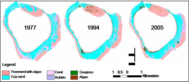
Figure A
The created or extracted/delineated forest area can have a control area or boundary with no human interference by using the buffer method as well as spatial analysis to find proximity to the urban areas etc. The buffer is created along the drainage network as per the need to find the flood-prone areas in the below figure B. The other figure C is showing the distance or proximity of the forest and built-up area which can be used to plan urban development or maybe a new transport system.
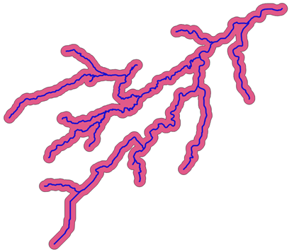
Figure B
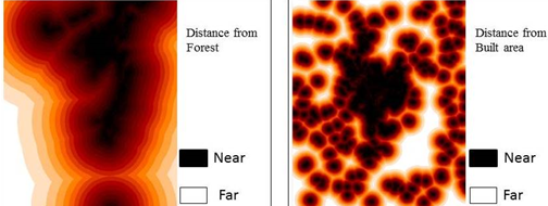
Figure C
The spatial analysis can be used to monitor the change in the forest areas where this change is integrated with a simulation model (such as Markovs’ method, Cellular Automata or ANN) to find or predict change for the future. The predicted future change can be used for the planning and management of natural resources.
Figure D is showing the predicted data for 2016 and 2030 using the simulation methods/models. These predicted data are prepared using the previous changes in land use which were mapped using satellite images. In this analysis, 2016 was used as a base year to find the significance and accuracy of a prediction model. Based on this land use is predicted for 2030. This predicted land use can be used by planners for further process.
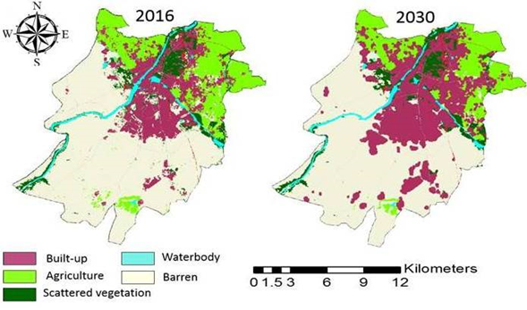
Figure D
Geospatial technology also felicitates to the creation of scenarios to analyze the same condition by using different constraints and factors (including locational and social factors). These scenarios will help to understand the conditional changes in the natural resources under different conditions. Figure E is showing mapped agriculture areas in different periods, as it is visible that the change in the built-up area leads to a loss in agricultural land.
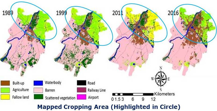
Figure E
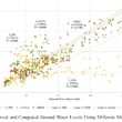
The geospatial technology-based analysis will help us to make policies by using current mapped data, predicted changes, and scenario-based analysis using current map data. While making the policies geospatial technology also allows us to integrate socio-economic data with geospatial data.
The below analysis in figure F is very important as it is showing the integration of socioeconomic data with spatial data. Through this process, one can analyze the impact of anthropogenic activities (human-induced activities) on natural resources.
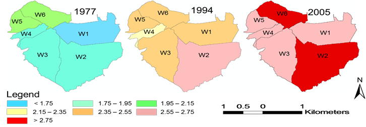
Figure F Spatio-temporal changes in watershed landscape development intensity (1977-05) Remarks: blue indicates the lowest human disturbance and red indicates the highest
Geospatial technology provides a unique way of data generation and updating databases periodically using GIS and remote sensing capabilities. This makes planners’ work easy and efficient to monitor and manage the development of the city as well as assess the negative impacts on the surroundings.
Here below sharing some important processes of Geospatial Technologies that can be used to control, conserve and preserve natural resources. This can be used by researchers, service providers, planners, policymakers, etc. for better monitoring and management of resources.
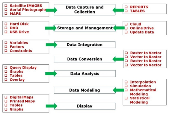
Figure G
In the conclusion, it is understood the role of geospatial technologies to save our earth by conserving and preserving natural resources as well as optimum use of natural resources. At present, this technology is used by many researchers, planners, etc. But now we need to integrate all the entities in this geospatial technology under one approach that invests in our planet in such a way that we may have sustainable development in all aspects.