What is GPS and How does GPS work? GPS (Global Positioning System) GPS is a satellite-based navigation system used byadminMarch 22, 2025
How to subset a satellite image in ArcGIS? The ability to subset a satellite image to concentrate on a particular area of byadminMarch 4, 2025
How to Change Band combination of satellite image in ArcGIS Use of Band Combination in Satellite Image Processing In satellite image byadminFebruary 24, 2025
Layer Stacking or Band composite of Landsat Satellite data using ArcGIS Integration of numerous spectral bands of Landsat byadminFebruary 17, 2025
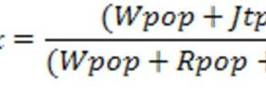
GIS AnalysisJuly 29, 2020 Geo-Spatial Analysis-Land Use Mix Spatial Data Analysis Introduction GIS is a versatile tool and can be used for variety of application byadmin
GIS Analysis GIS TutorialsJuly 1, 2020 Buffer Analysis using QGIS Introduction to Buffer Analysis GIS provide many tools for understanding and byadmin