Advantages of Multi Spectral/Band Satellite Images
Remote Sensing sensors record earth’s reflectance in different wavelength and these received reflectance value are processed to create separate image for each wavelength. The reflectance value stored for different wavelength in different layers, which are also called bands present in that satellite images.
Multi band images also known as multi spectral satellite images. Multi band image simply define, when more than one band/spectrum and at least three wavelength data recorded by sensor to create composite of satellite images. A sensor can record several wavelength simultaneously and it is completely depend upon sensor characteristics and capabilities.
As it is already studied that sensor can record earth surface feature in different wavelength from visible spectrum to infrared spectrum. The reflectance recorded from different wavelength can be converted in to satellite image.
In general three wavelength from visible i.e. blue wave length, green wavelength and red wave length, whereas infrared can be further defined as near infrared, mid infrared, far infrared and thermal infrared.
So it can be simply explained as capability of sensor to sense reflectance in to different wave lengths to create multi band or multi spectral images. For example Landsat 7 can record reflectance in seven wavelengths/bands.
Whereas Landsat 8 can record in eight wavelengths/bands excluding panchromatic band. LISS-III sensor of IRS series has four spectral bands and LISS-IV sensor of IRS series can record reflectance in three wavelengths.
Multi band/spectral analysis is studying earth surface in different wave length/bands. Multi spectra/band data are required to create color composite images in the form of natural color composite and false color composite.
All the image processing tools such as indices/rationing, principal component analysis, image fusion etc. can be used only if data collected in multi band. Each band in a multi spectral data collected through satellite, has unique reflectance values for same area with the change in wave length.
As reflectance will take place by mutual relation between incident wave length and material properties phenomenon. So reflectance may change with the change in wavelength for same earth surface feature. Multi band/spectral images ensure better and more accurate identification of earth surface features.
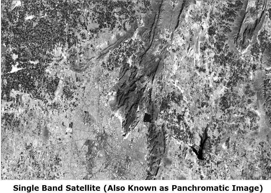
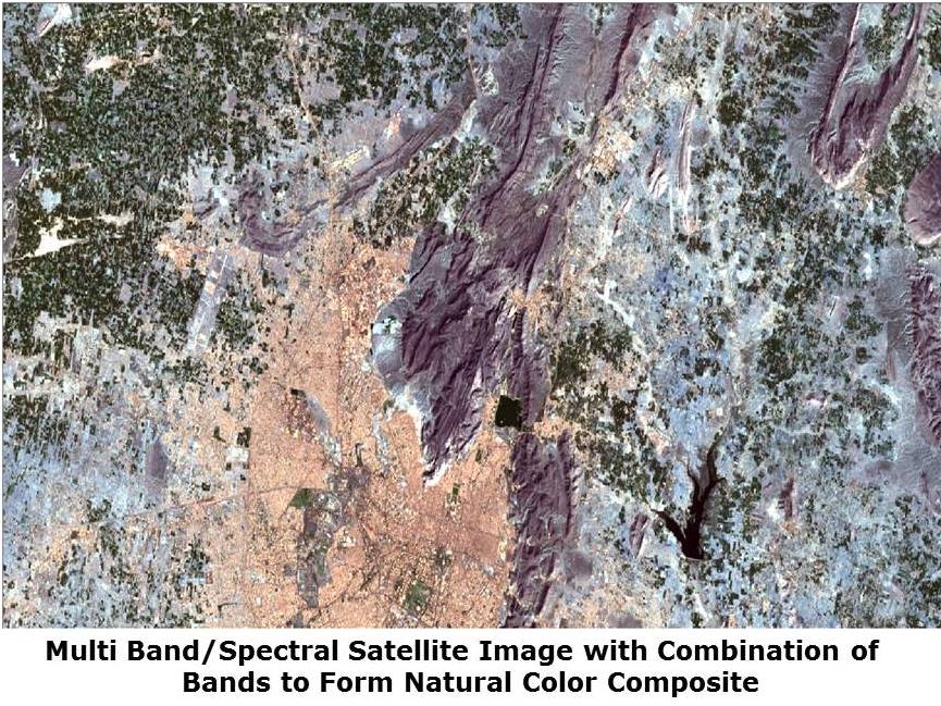
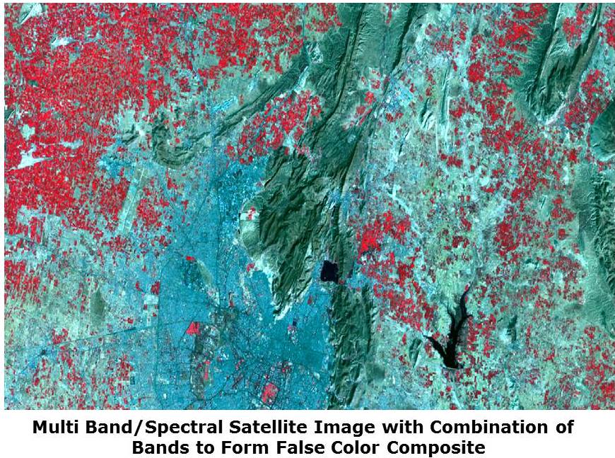
In the below images, three different images are shared to understand the advantages of multi band satellite images.
First image is showing earth surface object in grey scale or black and white. It is clearly visible from grey scale image that, visual interpretation is very much limited due to absence of colors in image. Identification of object also needs more experience to recognize and judging significance.
By looking below image which is prepared using multi band/spectral data, it is natural/true color composite. Identification of object becomes comparatively easy and accurate in natural color composite.
This image is showing a false color composite, in which infrared wavelength band is also integrated to create color composite. It is very advantageous as maximum reflectance of vegetation received in infrared and if it is not integrated than loss of information in that color composite. Which ultimate effect the accuracy of information extracted using satellite image classification process.
Therefore it can be explained that multi spectral images are very advantageous for extracting information and facilitate more accurate interpretation and classified thematic maps.
Due to more accurate date creation using multi band satellite images, it can be used to as input data in many studies such as urban planning, crop monitoring, forest mapping etc.