Re-project Satellite Image
This article Shared to understand projection and re-projection procedure and its importance in remote sensing images and database. Projected satellite images means that images are projected and they have coordinate information as well as a defined projection model to define the shape of our earth.
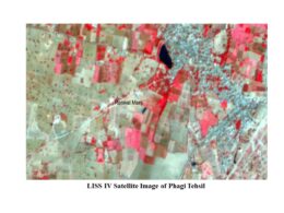
One of the best example of projected raster and vector data, which is used by everyone now a days using through many online app or websites.
In our daily life, we used to locate our self to find the transportation route to our destination or shortest path to reach our selected location. This process, we used to do by using different maps based apps or websites.
This correct shortest path or find route to destination only possible due to this projected database working behind in that app or website otherwise one will get distorted locations or route.
Projection Procedure
Projection is very significant and important procedure in remote sensing and GIS database as these data represents earth surface feature so correctness in location and area/distance play vital role.
Therefore all remote sensing data and GIS data corrected with reference to earth for accurate measurements on data of earth surface feature. So this procedure in which projection properties and parameters are defined to remote sensing and GIS database is called geo-referencing.
Advantages of Re-projection
If the remote sensing and GIS data are already projected in specific project system such as ‘geographic lat long’ and one need to bring this data in other projection system as per requirement such as ‘UTM’ (UTM stands for Universal Transverse Mercator) then one need to re-project spatial data.
Sometimes it happen that data of remote sensing and GIS are in some specific projection system but another new acquired data in some other projection system. So in this scenario one has to bring all remote sensing/GIS data in to common projection system for correct analysis and interpretation of information created using those data.
Its mean some GIS and Remote sensing operation will not effectively implemented if more than two data have different projection system and also remote sensing/GIS software will not support for such overlay analysis.
Therefore it is essential to bring all remote sensing/GIS data of study area to common or single projection system for correct and effective analysis in remote sensing/GIS environment. Here in below paragraphs will explain the re-projection of remote sensing data using image processing software (Erdas Imagine).
- Select DataPrep from main tools window of Erdas imagine then a data preparation tool window will open in that go to Reproject Images and click on it.
- A Re-project Images tool will open, in that select and click on input file option to select image which need to re-project for further process of re-project images.
- Also define output image which will be created using this re-projection process by making click on output file optionin extreme top right.

- After selecting and defining input and output file move to next step i.e. projection categories by drop down menu of Categories one can select projection system such as in this below image ‘Geogrpahic’ is selected.
- Then move to projection and select projection type from drop down menu, in this image ‘lat/long (Clarke 1986)’is selected as projection type.
- Rest of parameters such Unit, output cell size will be selected by default as per the projection type.
- It is important to define re-sampling methodin this example ‘nearest neighbor’is defined, as well as need to select one option either from rigorous or polynomial for re-projection procedure.
- If you select polynomial then polynomial order need to define and tolerance value for the process. These steps are the part of projection procedure.
- In the last click on OK and one will get a re-projected image as per defined new projection system.
Use of Re-projection
By this re-projection procedure one can bring all the images or raster data to common projection system for further analysis. This procedure help users to bring all data to same projection system and facilitate correct and accurate analysis which is also correct with reference to earth. As whatever one is creating, analyzing and interpreting in remote sensing/GIS environment that is going to implement on earth therefore correct projection system is vital for remote sensing/GIS data.