Applications of Remote Sensing
There are probably endless applications of remote sensing to tackle problems related to land, sea and atmospheric processes. Some of these applications are explained below-
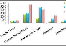
Land use/land cover change–
monitoring of land use change from rural to urban, direction of urban sprawl, reduction in valuable agriculture land, monitoring of environmentally sensitive areas etc.
High resolution images can be used to identify parking problems in city, traffic flows estimation and for various transportation studies.
classification of crop type, examine the crop health, estimation of crop yield and forecasting crop yield, mapping of soil characteristics and soil moisture, monitoring of farming practices etc.
Forest–
Forest cover type discrimination, forest inventory, biomass estimation, detect and monitor forest fires, burn delineation, monitoring the quantity and health of forests, mapping and monitoring the rate and extent of deforestation, rainforest depletion studies etc.
Geology–
Identification of rock type, structural mapping and terrain analysis, lineament extraction, exploration/exploitation of mineral and aggregate, geo-hazard mapping etc.
Oil and mineral exploration–
Locating natural oil seeps and slicks, mapping geological structures, oil field subsidence monitoring.
Glaciology–
Measuring ice cap volumes, ice stream velocity, and sea ice distribution.
Assessing water resources from snow, rainfall and underground aquifers, flood delineation and mapping, mapping and monitoring of wetlands, water quality monitoring, watershed modeling and drainage basin mapping, river/delta change detection, irrigation canal leakage detection etc.
Measuring sea surface temperature, mapping ocean currents, shallow water bathymetry, water quality monitoring, ocean color and phytoplankton concentration, oil spill detection, sea surface height and sea roughness estimation, planning ship route, delineation of land/water interface, mapping and monitoring of shoreline features, coastal vegetation mapping, assessing impact of human activity on coral reefs etc.
Climate-
The effects of climate change on glaciers and Arctic and Antarctic regions
Meteorology –
Study of atmospheric temperature, pressure, water vapour, and wind velocity.
Disaster warning and assessment –
Monitoring of floods and landslides, volcanic activity monitoring, assessment of damage zones from natural disasters.
Planning applications –
Mapping ecological zones, monitoring deforestation, monitoring and prediction of urban land use change.
Military–
Develop precise maps for planning, monitoring military infrastructure, monitoring ship and troop movements.
Hi there, I read your blogs on a regular basis. Your humoristic style is witty, keep it up! Thank You for Providing Such a Unique and valuable information, If you are looking for the bestLand Capability Asseessment for Wastewater in Victoria, then visit The 4 Spheres.I enjoyed this blog post.